How to add custom offline map data
Offline maps are available only in GPX Viewer PRO. So this how to won't work in the free version of GPX Viewer.
GPX Viewer PRO supports adding custom offline map data stored in MBTiles (SQLite database) files. These MBTiles must contain offline map data in raster format (images, for example, png or jpeg).
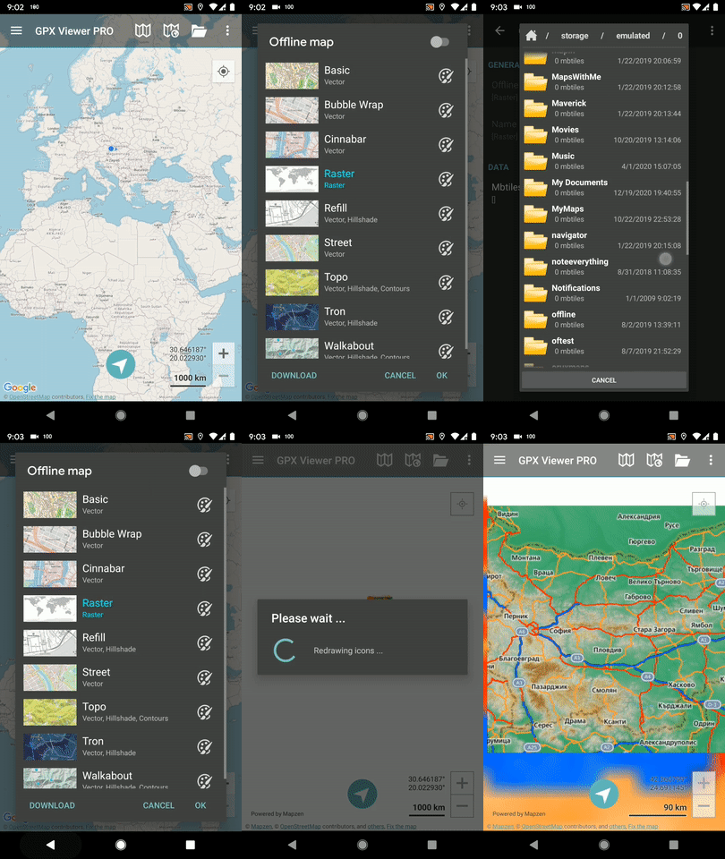
Below are step-by-step instructions on how to add custom offline map data stored in MBTiles.
- First off you need to start GPX Viewer PRO.
- In top toolbar tap on map button without globe. If you hide this button previously tap on … button in the top right corner of this top toolbar and from the menu select Offline map. If you have also hidden this button, open the left main menu, then tap on the Settings button. In the settings screen tap on the Maps button and then Offline map data manager, when you do this you can continue to step 4 of this how to.
- In Offline map dialog tap on Raster map item. Then tap on the paint button to the right of the Raster map item.
- In Offline map style tap on the MBTiles file with raster offline map data item, then in the file browser find and select your custom offline map data stored in the MBTiles file.
- Tap on the back button.
- Tap on switch button in top right corner of Offline map dialog to enable this switch. Then tap on OK button.
- GPX Viewer PRO will switch to an offline map and show it shortly on the screen. If you have a blank screen instead try zooming out to world-level zoom and then try zooming in.
Below is a video showing the instructions above:
